As many know, Pearl Harbor is honored every year on December 7 as the day we were attacked by the Japanese and started our involvement in World War II. I chose to focus on this Superfund Site because I had family members stationed at Pearl Harbor and this area has meaning behind it.
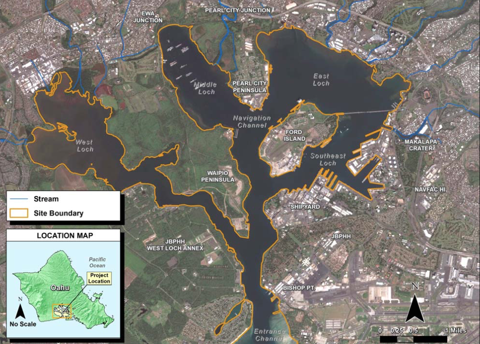
The Pearl Harbor Naval Complex in Honolulu, Hawaii includes approximately 12,600 acres of land and water which is currently an active military facility. The soil, sediment and groundwater is contaminated with metals, organic compounds, and petroleum hydrocarbons. There is no immediate threat to human health or environment. The site was discovered as a Superfund in the 1980s shortly after CERCLA was passed, and was proposed to be on the National Priority List (NPL) on July 29, 1991 and was placed on the NPL on October 14, 1992. This Superfund is so large it has 39 Operable Units (OU) with what is known as the "Superfund Six" because the Hazardous Ranking System (HRS) because they reflect the different types of pathways by which the contaminants can enter the environment. To get onto the NPL you need an overall score of 28.5, and Pearl Harbor received a 70.82. For more information on The Naval Complex, check out this interesting read: bluewaternavy.org/bases/SuperfundSix.pdf
Previous Environmental Investigations had been conducted on the harbor itself before conducting a Remedial Investigation in 1996, a few years after being placed on the NPL. The EPA thought the contaminants were contained to the land but later found out the harbor was filled with sediments and chemicals from the contaminated ground. The RI included sampling and laboratory analysis of the sediment and tissue from species within the harbor, and found approximately 243 chemicals in the sediment and organisms that many locals were consuming. For this area, the EPA actually did a pilot study for the EPA Environmental Monitoring and Assessment Program in 2002 which found several chemicals that were also found in the superfund site, however the concentration levels were significantly decreased compared to the levels in 1996 which lead to the EPA choosing No Active Remediation for the harbor in four Decision Units (DU), while the remaining six were still under investigation because the levels in those DUs were still considered a threat to human health and the environment. In 2012, the Navy issued an FS investigation to collect data on those six DUs from 2002 and found that six metals still remained that needed to be remediated at the site including antimony, cadmium, copper, lead, mercury and zinc. The FS investigation evaluated these chemicals of concern and their levels within the harbor and marine life as well as if there is a source continuing to add these chemicals to the harbor which then received recommendations for necessary remediation. For DU1 Southeast Loch chose to dredge and placing a clean layer of sand over drudge residuals which can cost up to $47 million. DU2 Oscar 1 and 2 Pier Shorelines chose to place a six inch layer of clean material over three acres to enhance a natural recovery process which can cost up to $2.5 million.
DU3 which its right off Ford Island chose placing approximately 6 inches of clean sand to enhance the natural recovery process which will cost approximately $270K. DU4 which is Bishop Point chose the six inches of clean sand to natural enhance a recovery process which will be $1.2 million. DU E-2 which is off of Waiau Power Plant chose dredging which will cost about $5 million, and finally DU E-3 chose long term monitoring to make sure the chemicals of concern are being taken care of naturally. The debris from dredging will either be taken to a landfill or disposed of farther out in the ocean.
More information can be found here: yosemite.epa.gov/r9/sfund/r9sfdocw.nsf/cf0bac722e32d408882574260073faed/ae2cf2470e9eeab788257f65005cf5c0/$FILE/11690803.pdf/FINAL%20PP%20PH%20Sediment.pdf
The construction is still not complete, the human exposure status is not under control because of continued consumption of contaminated fish despite signs regarding people not to consume the fish. The contaminated groundwater has insufficient data and cannot determine if the groundwater is stabilized. The site is still not ready for anticipated use due to the groundwater and fish contamination.